TRAVEL
| FRONT PAGE | NAYARIT NEWS | Tara’ Best Bets |
TRAVEL | HOME & LIVING | MEXICO INSURANCE PRODUCTS |
TRAVEL BUDDIES |
Name: Zacatecas is named after the indigenous people the Zacateco people which is Nahual for “People of the Grasslands.”
Location: Located in the north-central Mexico, Zacatecas is squeezed between Sierra Madre Occidental and another subrange called Sierras y Valles Zacatecanos. The land is hilly and rugged.
Weather: Semi Arid climate with rain falling between June and October. Temperate summer and cool wnters. Freezing is not uncommon.
January Average Highs 17.8C (64F) Lows 4.7C (40.5F)
July Average Highs 23.8C (74.8F) Lows 11.8C (53.2F)
Population: 130,000 Municipal
Elevation: 2,440 m (8,010 ft)
Founded: 1548
Medical: Major medical
Money: Major Banks, ATMS
History:
Today:
Getting there:
Drive from.Durrango or Aguascalientes on Highway 45 and or 45D.
From Saltillo drive West on Highway 54
| Insurance for your American or Canadian Vehicle while in Mexico | Insurance for your Mexican Vehicle |
“Acapulco is the big daddy of Mexican Resorts. It was where all the movie stars went to party. Remember Elvis Presley and some cheesy flick about Acapulco?
This is where the government and industry learned that resorts and tourism could mean big money and they have tried to duplicate the success throughout the country.
We have enjoyed Acapulco with our kids and alone; in our RV or at a hotel. There seems like there is something for everyone and it works.”
Dorothy Bell
 Name: Full name is Acapulco de Juárez. Acapulco means “where the reeds were destroyed or washed away” in the Nahuatl language. Juarez is to honor Benito Juarez President of Mexico.
Location: Acapulco sits on the Acapulco Bay on Mexico’s Southern Pacific coast.
Weather: Tropical climate with distinct wet and dry seasons. Storm and hurricane season is May to November.
January Average Highs 30.4C (86.7F) Lows 23.3C (73.9F)
July Average Highs 32.3C (90.1F) Lows 25.1C (77.2F)
Population : 688,000 City, 1,021,000 Metro
Elevation : Sea level to 30 m (100 ft)
Founded : 1520s
Medical : Hospitals, Doctors, Dentists
Money : Major Banks & ATMs everywhere
History:
Today:
Getting to Acapulco can be accomplished via various modes of transportation, depending on your starting point and preferences. Here are the main options for traveling to Acapulco:
By Air
- International Flights :
- General Juan N. Álvarez International Airport (ACA) : Located about 26 km (16 miles) from the city center, this is the main airport serving Acapulco. It receives both domestic and international flights.
- Direct Flights : There are direct flights to Acapulco from major cities in Mexico, the United States, and Canada. Airlines such as Aeroméxico, Volaris, and American Airlines operate routes to Acapulco.
- Connecting Flights : If there are no direct flights from your location, you can fly to Mexico City (Benito Juárez International Airport) and then take a domestic flight to Acapulco. The flight from Mexico City to Acapulco is about 1 hour.
By Road
- Driving :
- From Mexico City : The drive from Mexico City to Acapulco is approximately 380 km (236 miles) and takes about 4-5 hours via the Autopista del Sol (Highway 95D). This toll road is well-maintained and offers scenic views.
- Car Rentals : Renting a car is an option if you prefer the flexibility of driving. Car rental services are available at major airports and cities.
- Bus :
- Luxury Buses : Several bus companies offer comfortable and affordable services from Mexico City to Acapulco. Estrella de Oro, Costa Line, and Futura are some of the popular bus lines. The journey takes about 5-6 hours.
- Bus Terminals : In Mexico City, buses to Acapulco depart from major terminals such as Terminal de Autobuses de Pasajeros de Oriente (TAPO) and Terminal de Autobuses del Sur.
By Sea
- Cruises :
- Cruise Ships : Some cruise lines include Acapulco as a port of call on their Pacific Coast itineraries. This option provides a scenic and leisurely way to reach Acapulco.
Local Transportation
- From the Airport to the City Center :
- Taxis and Shuttles : Taxis and shuttle services are available at the airport to take you to your hotel or destination in Acapulco. It’s advisable to use authorized taxi services for safety and reliability.
- Car Rentals : Car rental agencies are available at the airport if you prefer to drive yourself.
Tips for Travelers
- Travel Documents : Ensure you have the necessary travel documents, including a valid passport and any required visas.
- Safety : While Acapulco is generally safe for tourists, it’s always good to stay informed about local safety advisories and take common-sense precautions.
- Currency : The local currency is the Mexican Peso (MXN). It’s useful to have some pesos on hand for small purchases and transportation.
By air, road, or sea, there are multiple convenient options to reach Acapulco and enjoy all that this vibrant destination has to offer.
| Insurance for your American or Canadian Vehicle while in Mexico | Insurance for your Mexican Vehicle |

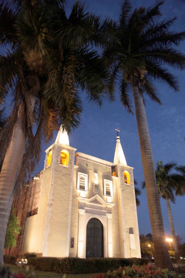
 “Merida is a great place to discover and explore the Northern Yucatan. You can use it as a home base while you discover the flamingos at Celestun or the Uxmal ruins or the many ancient churches in the area.
It also has all the magic for evening strolls downtown where you will discover this Mayan city’s great foods, music and joy of life. Truly a fine place to be.”
Name: Named after the Spanish town Merida in Extremadura, Spain.
Location: Located
Weather: Extremely Hot in the summer. Hot winters.
 Mérida enjoys a tropical climate with distinct wet and dry seasons. The weather is generally warm to hot year-round.
 January Average Highs 30.8C (87.4F) Lows 17.2C (63F)
July Average Highs 35.0C (95F) Lows 21.4C (70.5F)
Population: 971,000
Elevation: 10 m (30 ft)
Founded: January 6, 1542
Medical: Hospitals, Clinics, Doctors, Dentists
Money: Banks, ATMs
History: A Historical Gem
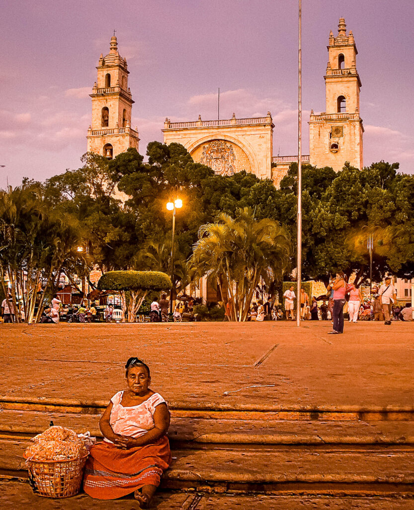
 Merida is a city built on the ancient Maya city of T’ho, also known as Ichcaanzihó, which means “city of the five hills,” referring to its five pyramids. This city was a hub of Maya culture for centuries, making Mérida one of the oldest continually-occupied cities in the Americas.
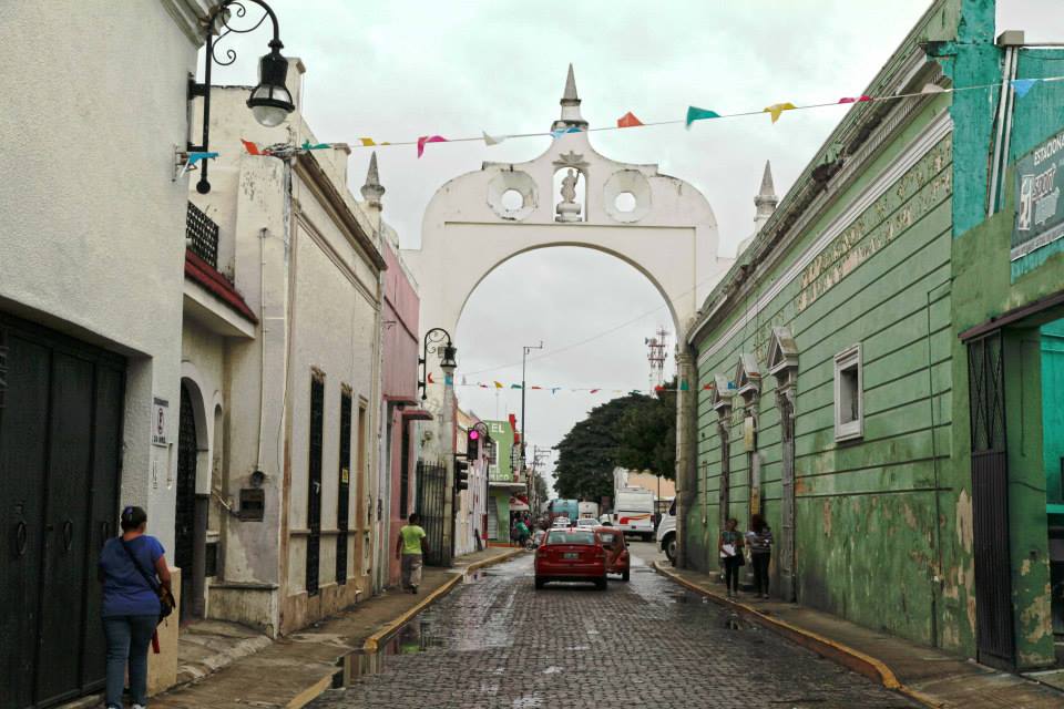
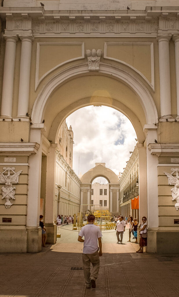
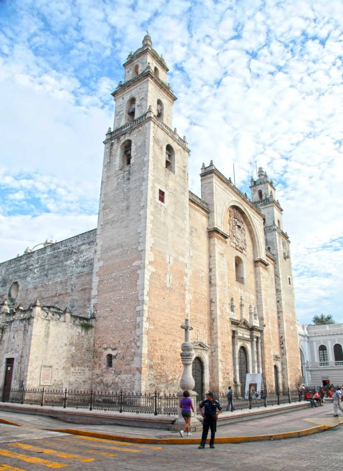 Originally, Mérida was a walled city, designed to protect the Spanish and Criollo residents from Maya revolts. Some of the old city gates still stand, although the city has since expanded well beyond its original walls.
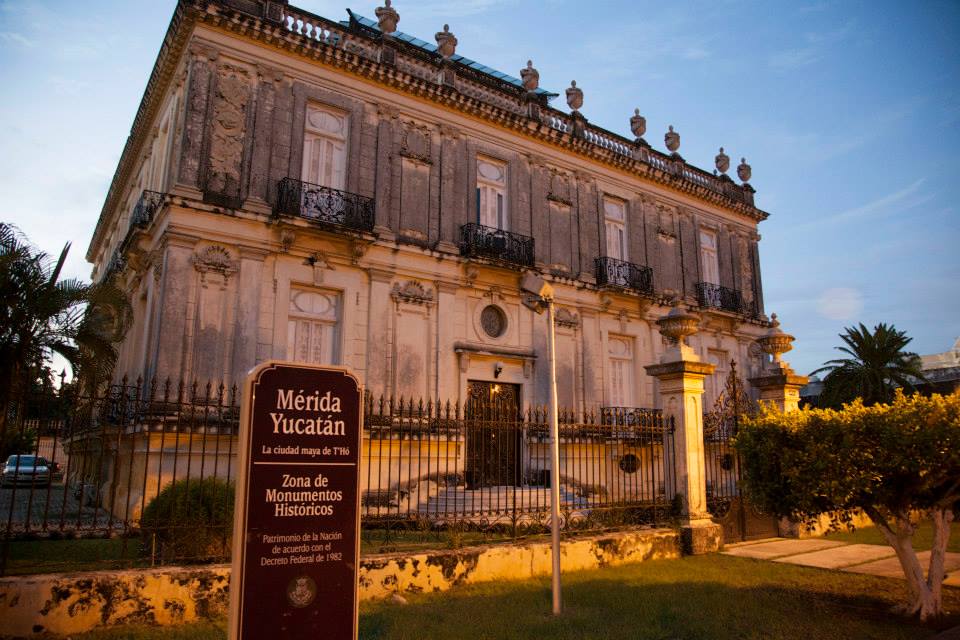
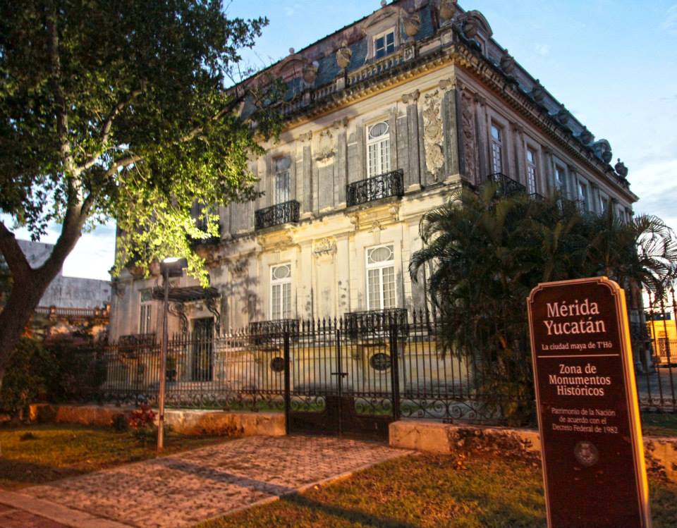
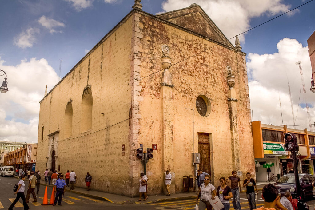 Mérida boasts one of the largest historic districts in the Americas, only surpassed by Mexico City and Havana, Cuba. The centro historico is filled with colonial homes in varying states of disrepair and renovation. The area is experiencing a revival as more people move in and restore these historic buildings.
Today:
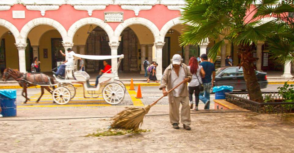 Mérida stands out from other Mexican colonial cities for several reasons:
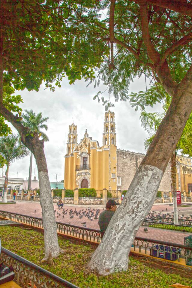 Henequén Wealth: Mérida’s prosperity from henequén production in the late 19th and early 20th centuries led to the construction of grandiose mansions along Paseo de Montejo, setting it apart from other cities with fewer such structures.
 Modern Amenities: Despite its historical significance, Mérida is a modern city with excellent infrastructure, healthcare, and educational facilities, making it a comfortable place to live and visit.
 Palacio de Gobierno: The government palace, featuring beautiful murals depicting the history of the Yucatán.
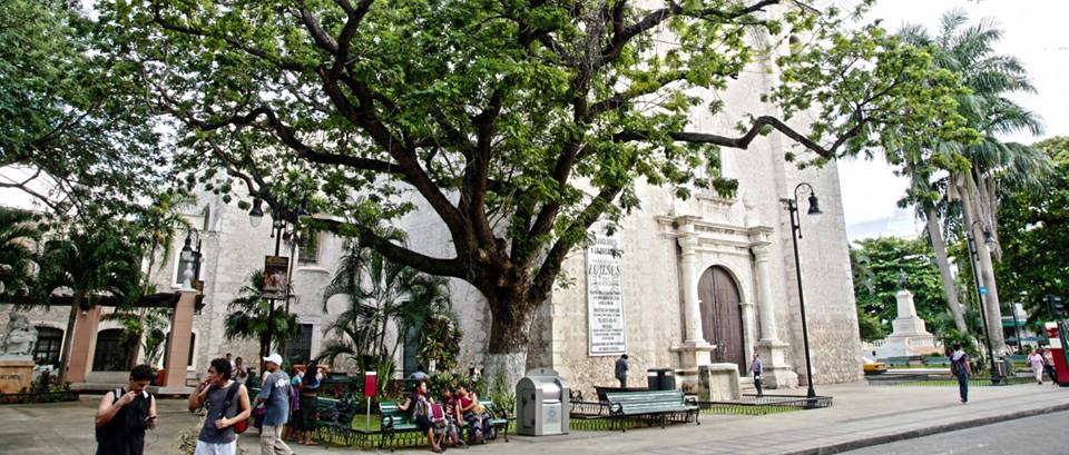
Drive from Campeche Drive Highway 180 North. 173 Kilometers 2 hours 15 minutes.
Drive from Cancun: Drive Highway 180 West. 308 kilometers 3 hours 15 minutes

“The town is active and authentic Mayan. Lots of plants and flowers. Museums and cultural exhibits. Music. Plays.
A wonderful spot to visit.”

Introduction
Comitán de Domínguez is a vibrant and authentic Mayan town brimming with cultural richness and natural beauty. Visitors are greeted with lush greenery, abundant plants and flowers, as well as a thriving cultural scene with museums, exhibits, music, and plays. This charming town offers a unique and enriching experience.
 Location
Comitán de Domínguez is located in east-central Chiapas, near the Guatemalan border. Its strategic location makes it a gateway to various cultural and natural attractions in the region.
Cultural and Natural Attractions
- Museums and Cultural Exhibits: Comitán is home to numerous museums and cultural exhibits that showcase the rich history and heritage of the region.
- Music and Theater: The town has a vibrant arts scene with regular music performances and theatrical plays.
- Flora and Fauna: The town’s gardens and parks are filled with a diverse array of plants and flowers, making it a haven for nature lovers.
- Authentic Mayan Experience: The town retains its authentic Mayan roots, offering visitors a glimpse into traditional Mayan culture and customs.
Name and History
Originally known as Balún Canán, meaning “Nine Stars” in the Mayan language, the town’s name was later changed by the Aztecs to Comitlan, derived from the Nahuatl language meaning “Place of Potters.” Over time, it evolved to Comitán de Flores and finally, in 1915, it was renamed Comitán de Domínguez in honor of Dr. Belisario Domínguez, a native son. Dr. Domínguez was a courageous figure who was assassinated for his outspoken criticism of Dictator Victoriano Huerta in Congress.
 Weather
Comitán de Domínguez enjoys a subtropical highland climate, which is moderated by its altitude. The weather is generally humid and varies between warm and cool throughout the year. The rainy season spans from May to October, bringing refreshing showers and lush landscapes.
January Average Highs 23C (74.5F) Lows 8.7C (47.7F)
July Average Highs 25.3C (76.6F) Lows 12.6C (54.7F)
 Population: 142,000
Elevation: 1,670 meters (5,500 feet) above sea leve
Founded: Founded by the zeltal eoples and then subjugated by Aztec warriors in 1486
Medical: Hospital, doctors, dentist
Money:Many banks and ATMs
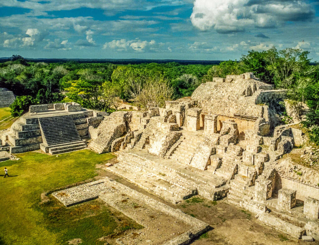
Visit the Archeological site of Tenam Puente, Chiapas nearby
Getting there:
By Air: The nearest major airport is Ángel Albino Corzo International Airport (TGZ) in Tuxtla Gutiérrez, which is approximately 150 kilometers (93 miles) from Comitán. From the airport, you can rent a car or take a bus to Comitán de Domínguez.
 By Bus: Comitán is well-connected by bus services from major cities in Chiapas and surrounding states. Buses from Tuxtla Gutiérrez, San Cristóbal de las Casas, and other nearby cities provide regular service to Comitán. The bus ride from Tuxtla Gutiérrez takes about 2-3 hours.
By Car: If you prefer to drive, Comitán is accessible via Federal Highway 190. The drive from Tuxtla Gutiérrez takes approximately 2.5 hours. Renting a car gives you the flexibility to explore the surrounding areas at your own pace.
By Shuttle: Private shuttle services are available from various cities and can be a convenient option for groups or those who prefer a direct route without the hassle of multiple transfers.
 Accommodation
HOTELS- All budgets
NO RV PARKS NEARBY
Conclusion
Comitán de Domínguez is a wonderful spot to visit for those looking to immerse themselves in the cultural and natural beauty of Chiapas. Its rich history, vibrant arts scene, and lush environment make it a must-visit destination. With multiple travel options available, getting to this charming town is easy and convenient.

| Insurance for your American or CanadianVehicle while in Mexico | Insurance for your MexicanVehicle |
 Tenam Puente is a fascinating medium-sized Mayan archaeological site located in the Mayan Highlands, just 12 kilometers south of Comitán in Chiapas. The site is easily accessible by bus or car and offers visitors stunning views, three ancient ballcourts, and climbable pyramids and plazas.
Name and Historical Significance
The name Tenam Puente translates to “Wall Bridge.” “Tenam” means wall, referencing the site’s strategic fortifications, and “Puente” refers to a 1900s farm bridge that once existed there.

Tenam means Wall and Puente refers to a 1900’s farm bridge that exited here.
 Tenam Puente Fast Facts
- Culture: Mayan
- Dates of Occupation: Built between 300 to 600 AD, peaked from 600 to 900 AD, and remained occupied until around 1200 AD.
- Location: 12 kilometers south of Comitán in Chiapas, Mexico.
- Elevation: 1700 meters above sea level
- Discovery: Mentioned by Franz Blom and Oliver La Farge in their 1928 book
- Hours: 8 am – 5 pm
- Cost: 35 pesos


Tenam Puente is located in the highlands of Chiapas, Tenam Puente rests high on the hill with views of the Comiteca plain – a strategic location for trade and commerce for the Maya between the Guatemalan highlands with the Mayan Lowlands. It allowed the inhabitants a measure of control over the lucrative and flourishing trade route. Shells from the Gulf coast and ceramics from varying regions have been found here.
The large buildings and temples are built into the hillside on five terraces that were levelled for construction; again strategic and aesthetic views were optimized by the location and strategic planning..
The centre core of the site is approximately 30 hectares and contains approximately 60 structures – the most important are what is known now as the Acropolis. From the top of the structures and temples you have long views of the Comiteca plain.
Tenam Puente boasts three different ball courts signifying not only love of the sport but also the prominence of the city. It is speculated that Mayan ball courts were not only used for the game but were also used for entertainment and politics. It is further suggested that ball courts were used as proxy court to settle various commercial and political disputes.
Unique Features
- Ballcourts: Tenam Puente features three different ballcourts, highlighting the importance of the ballgame in Mayan culture. These courts were not only venues for sport but also served as sites for entertainment and political events, possibly even acting as proxy courts for settling commercial and political disputes.
- Construction Techniques: The buildings at Tenam Puente are unique in that no mortar was used to connect the calcareous stone pieces. Instead, the stones were perfectly cut and fitted together, with stucco used as a covering. Unlike other Mayan sites, the buildings here are relatively plain and lack ornate decorations.
Visiting Experience
One of the highlights of visiting Tenam Puente is climbing the 20-meter high tiered pyramid. From the top, you can enjoy commanding views of the highland plain, providing a tranquil spot for reflection. The site is usually not crowded, offering a peaceful experience without the presence of vendors or hawkers.
Getting There
To reach Tenam Puente, drive south from Comitán on Mexico Highway 190. After 12 kilometers, turn west and continue for 7 kilometers to reach the site. The journey is straightforward, and the site is well-signposted.
Conclusion
Tenam Puente is a captivating destination for anyone interested in Mayan history and culture. Its strategic location, unique construction techniques, and peaceful atmosphere make it a must-visit site in Chiapas. Whether you’re an archaeology enthusiast or simply looking for a serene spot to explore, Tenam Puente offers a rewarding and insightful experience.
Valladolid Yuctan 

“This small charming colonial city is out favorite when visiting Chichen Itza, the surrounding cenotes, ancient sites and pueblos. It has a certain real charm with plenty of great things to do nearby.
We also love the small town square where you can people watch all day long. Come and enjoy!”
 Name: Valladolid Yucatan Named after the then Capital of Spain. Named a Pueblo Mágico August 30, 2012
Located between Merida and Cancun in the interior of the Northern Yucatan Peninsula

Weather: Hot in the summer. Hot winters.

January Average Highs 29.8C (85.6F) Lows 17.1C (62.8F)
July Average Highs 34.6C (94.3F) Lows 22.2C (72)
 Population: Approximately 50,000
Elevation: 10 meters (30 ft)
Founded: May 28, 1540 by Francisco de Montejo (the Nephew)
Medical: New Hospital, clinics, doctors, dentists
Money: Banks and ATMs

History:
 The Former Convent of San Bernardino de Siena, located in Valladolid, Yucatán, Mexico, is a historic site that dates back to the 16th century. Established by Franciscan missionaries around 1552, this convent was built to aid in the conversion of the local Mayan population to Christianity. It is situated in the Sisal neighborhood, which was once an important Mayan community.
 The architecture of the convent is a blend of Spanish colonial and local Mayan elements, featuring thick walls, large arches, and a fortified appearance, typical of many religious buildings of that era in New Spain. One of the most notable features of the convent is its cenote, a natural sinkhole that was used by the Mayans as a water source and holds spiritual significance.
 Throughout its history, the convent has served various purposes, including as a religious center, a fortress during the Caste War in the 19th century, and currently, as a museum and cultural site. Visitors can explore its spacious courtyards, ancient frescoes, and tranquil gardens, making it a significant historical and tourist attraction in Valladolid.


Today:
Getting there:
From Cancun: Drive 180D West. 160 Kilometers 1 hour 35 minutes
Villahermosa, Tabasco
 “Villahermosa has always been a great spot to visit. It has the fantastic Park and museum to explore the Olmec culture, the colonial downtown with old carefully crafted buildings and a plethora of modern shopping malls and stores to stock up before you continue the journey.”
Name: Beautiful city in Spanish. Named by the Mayor of the Yucatan, Diego de Quijada, in 1560 who was appointed by King Philip II of Spain.
Location: Located in the state of Tabasco at the southern point in the Gulf of Mexico.
Weather: Very hot in the summer. Hot in the winter winters.
January Average Highs 27.9C (82.2F) Lows 19.3C (66.7F)
July Average Highs 33.9C (93F) Lows 23.8C (74.8F)
Population: 641,000
Elevation: Seal level to 20 m (70 ft)
Founded: 24 June 1564
Medical: Major City with hospitals, clinics and other medical facilities
Money: Banks, ATMs
Getting there:
From the East Drive Highway 45 south and then east. It turns into Highway 180. Continue to Villahermosa.
From Merida drive south on Highway 180 and 180 to Villahermosa
Catavina, Baja California

Cativina is a small town in the middle of the Baja, approximately 160 kilometers (100 miles) south of Tijuana. The population hovers around 150 people.
 This is harsh desert country with ranching and tourism being the main occupational categories. Rancho San Innes is an ejido – a Mexican cooperative land area – that offers camping, rooms and a restaurant. There are springs nearby and you can see a trail of water at times by the foot of some palms.

A hotel was built by the government to promote tourism and is now run independently. There are solar gas pumps that are more frequently off than on. Another RV Park is right beside the hotel. Men sell gas out of drums at the side of the road.
 You can visit cave paintings nearby with the aid of a guide.

The Cativina rock ensemble plays free 24/7 nearby.


 As I stroll through the vibrant streets of Guadalajara, I am reminded why this city never ceases to amaze me, even after decades of visits. Nestled in the heart of Jalisco, Guadalajara blends tradition with modernity, creating a captivating tapestry of culture and history. My favorite place to stay has always been the Historic Centro, where each corner holds a story and every plaza invites exploration.
 Guadalajara is a city of artists, and the Centro is a testament to this creative spirit. Vibrant murals and sculptures adorn public spaces, each piece telling its own story. The imposing figure of La Mujer en el Corazón de México stands proudly, a striking sculpture that captures the essence of the city’s artistic soul. Nearby, street performers and mariachi bands fill the air with music, creating an impromptu celebration that invites everyone to join.


